production

Coed-y-Brenin

Coed-y-Brenin, Gwynedd, Wales

4.12 KM

A short walk through the Coed-y-Brenin Forest, following the River Mawddach to the Pistyll Cain waterfall.

9 Jun 2021
Flat
1hr, 50min (1hr, 2min)
altitude Graph for coed-y-brenin walk

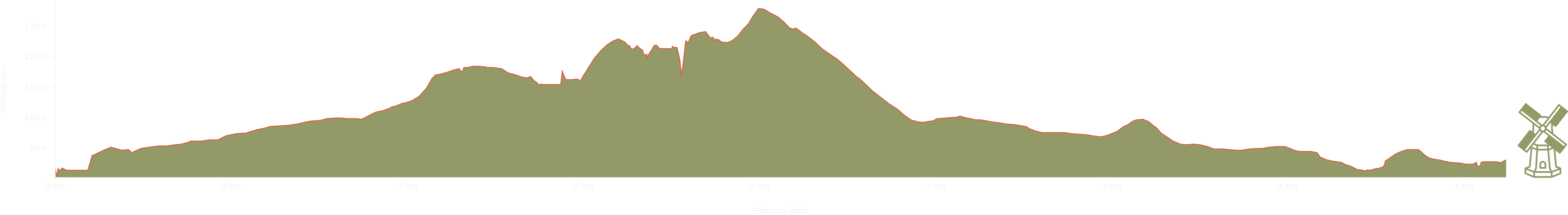
Elevation: Max 136m, Min 80m, Gain 56m

Pictures from the walk

waterfall in summer

Pistyll Cain Waterfall

forest with trees, ferns and wildflowers

The Coed-y-Brenin Forest

stone river bridge

Bridge over the River Mawddach

sign on tree reading 'private property no gold panning'

No Gold Panning

river with overhanging trees

Afon Mawddach (River Mawddach)

Some walks nearby

large boulder on the hillside
Rhobell Fawr

Rhobell Fawr is the site of an ancient volcano in the Snowdonia National Park. This route up the mountain starts and ends in the village of Llanfachreth. As it nears the summit, …

walker with poles scrambling over rocks on Rhinog Fawr
Rhinog Fawr

We didn't quite reach the summit of Rhinog Fawr on this walk from Llyn Cwm Bychan, but instead climbed The Roman Steps up to the mountain lake and then had fun scrambling …

mountain peak visible in the clouds
Cadair Idris

Well...not quite. We had a few navigational and weather issues on this walk and had to miss out on the summit of Cadair Idris itself. The path up involved crossing a couple …